Project background
The northern access into Christchurch is already under pressure and this will only increase as the region grows. How does this project fit into future plans for Christchurch and how will it solve transportation issues.
Pre-construction consultation 2010–15
Following extensive community and stakeholder consultation the NZ Transport Agency announced its plans for the Christchurch Northern Corridor in September 2011. Consultation with the community and stakeholders throughout 2010–14 has helped to shape the final design, with changes made where safety and function would allow.
Consenting in late 2014 and early 2015 provided further opportunity for the community to share their views on this project.
A designation (protection) on the land needed between the Waimakariri and QEII Drive has been in place for over 35 years. However this designation was not wide enough for a modern four-lane road with the associated pedestrian/cycleway and mitigation measures required (stormwater treatment, landscaping, noise barriers). A designation was also needed for the QEII Drive to Innes Road section of the project.
In mid 2012 the NZ Transport Agency formally lodged a Notice of Requirement advising the Christchurch City Council that we intended to alter (realign and widen) the existing designation.Resource consents from Environment Canterbury were also required for stormwater discharge and the construction of culverts and bridges. These applications were publicly notified in November 2014 and the submission period closed on 19 December 2014. All designation and consent are now in place.
The Transport Agency and Christchurch City Council would like to thank all those who take the time to provide feedback. Your ideas are valuable to us whether or not we can make the changes hoped for.
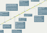
Key events
-
The August 2010 newsletter asked the community for feedback on the Christchurch Northern Corridor project.
-
Open days were held in November 2010.
-
A public meeting was held in February 2011 in the Winters/Grimseys Road area to explain and hear feedback on all the Christchurch Northern Corridor projects.
-
The project team then narrowed down the options and carefully considered the feedback received to come up with a solution.
-
The preferred solution for the Christchurch Northern Corridor was outlined in the September 2011 newsletter.
-
Ongoing consultation and negotiation with affected parties.
-
Consenting process for all the Christchurch Northern Corridor projects – late 2014 and early 2015.
Consultation history
August–September 2010
The August 2010 newsletter [PDF, 550 KB] sought feedback on a range of alignment and connection options.Specific options considered were:
- alternatives to stopping Factory and Ford roads
- access onto the Northern Arterial from Belfast Road
- alignment options for Prestons Road and Radcliff Road overbridges
- local road connections at QEII Drive
- priority connections at QEII Drive (to/from the port or to/from the city)
- location and extent of the pedestrian and cycle route
- movements in and out of Grimseys Road
- three Arterial alignment options in the Kaputone Creek Area between Belfast Road and just south of the Styx River (with each option crossing the Styx River in a slightly different location):
- following the existing designation alignment and is on the western side of Kaputone Creek
- along the eastern side of Kaputone Creek
- an eastern most alignment
- realignment of Kaputone Creek to avoid two stream crossings
- realignment or closure of Guthries Road.
The feedback period on the above matters closed on 1 October 2010.
Project open day – November 2010
The NZ Transport Agency held a public open day to discuss the proposed options and seek further community feedback on 16 November 2010. This was held at the Belfast Rugby Clubrooms (18 March Place, Belfast). NZ Transport Agency staff and the project consultants attended to discuss the options being considered for the project(At the open day information was also provided on the other Roads of National Significance project in the Belfast area: the Western Belfast Bypass.)
Public meeting – February 2011
In February a well-attended public meeting was held at Papanui Primary School. At this meeting the Christchurch City Council and the NZ Transport Agency outlined the northern corridor projects and detailed the plans for the QEII Drive interchange and access arrangements for the Winters Road area.
Project delay – Christchurch earthquakes
The next project newsletter was planned to go out in March/April 2011. As a result of the 22 February earthquake, this was postponed as many Christchurch residents were not in a position to devote time to responding to consultation – and we wanted to make sure everyone had an opportunity to have their say. Some NZ Transport Agency staff and our consultants and contractors were also working in earthquake recovery roles and others needed time to deal with accommodation issues of their own.Work on the Northern Arterial investigation recommenced in April 2011 including technical assessments and addressing of issues raised during consultation.
Preferred solution announced – September 2011
The project team assessed a range of potential alignment and access options. The chosen layout was outlined in the September 2011 Newsletter [PDF, 942 KB] delivered to over 2500 properties in the area.The September 2011 newsletter outlined the additional options looked at as a result of consultation and the changes made to the design. The newsletter presented the noise reduction methods proposed for the project. The newsletter also outlined the next steps in the planning process, where to find more information and who to contact. Christchurch City Council contact information was provided for the Northern Arterial Extension and the Cranford Street Upgrade project.Following this the project team continued to work on the project plans and followed up issues and concerns raised by the community.
Joint NZ Transport Agency and Christchurch City Council project consenting
The consenting process for the Northern Arterial was run jointly with the Christchurch City Council’s projects – the Northern Arterial Extension, the Cranford Street Upgrade and the Cranford Street Basin Project.To follow is a timeline for this process:
- Notice of Requirement and Resource Consent applications were lodged for the Northern Arterial in 2012 and for the Christchurch City Council projects in 2014.
- A joint public notification was made on 15 November 2014, giving the community another opportunity to have their say by making a submission.
- Submission period closed – Friday 19 December 2014.
- Hearing – autumn 2015.
- Recommendations from the commissioners – later in 2015.