
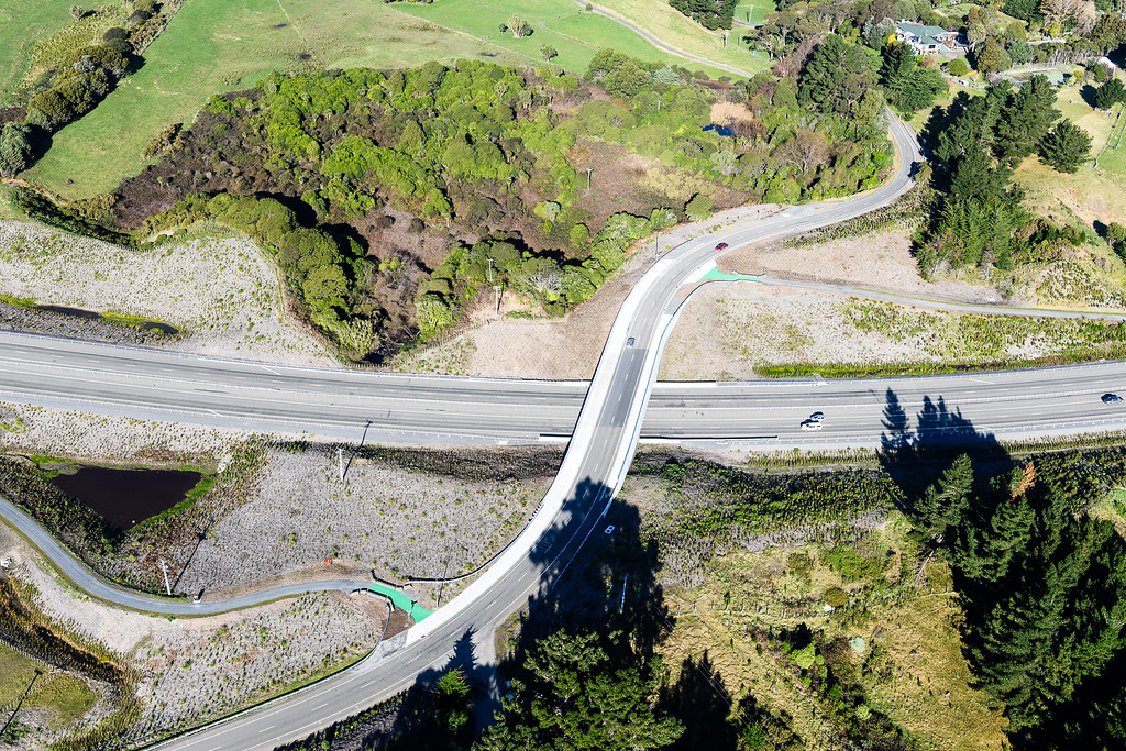
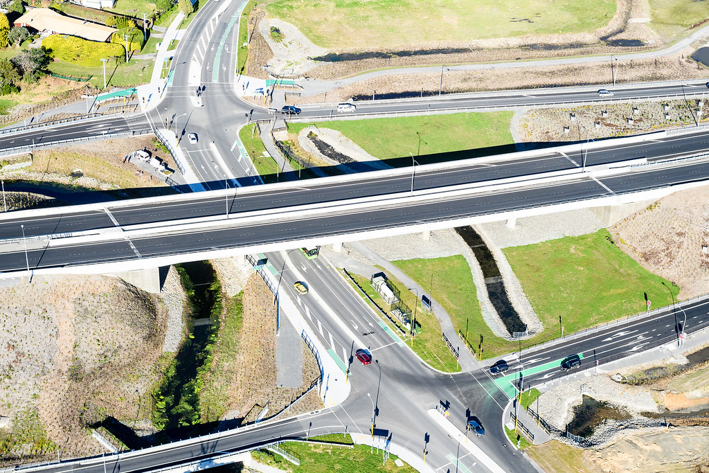
An 18km four-lane expressway that takes State Highway 1 along the Kāpiti Coast, and is the first of the Wellington Northern Corridor projects completed. It separates local and highway traffic and aims for safer and shorter trips to and through the Kāpiti Coast - with local and national benefits.
If you’re interested to see where the road travels, take a look at our overarching connections graphic [PDF, 583 KB], or for more detail check out the complete plan [PDF, 7.8 MB] for the M2PP Expressway.
Below you can find out more about how to use the Mackays to Peka Peka Expressway, as well as more information about the M2PP application to the Environmental Protection Agency (EPS) and a full list of our resources.
A world-first innovation is the unique application of cloud-based Global Navigation Satellite System GNSS technology to achieve millimetre-accurate excavation. The technology has been around for a while. But M2PP Alliance and local sub-contractor Goodmans achieved a world first by aligning technology, produced by US-based company Trimble, with the internet and GNSS to give the project team – including the digger operators – a precise and real-time 3D picture of what’s being dug. Such precision pays dividends, particularly as the project will move 3.5 million cubic metres of material. It means a safer worksite, the work gets done faster, and it’s much more cost efficient.
CloseBlue tooth technology is being used to tell drivers how long it will take them, right now, to get from place to place on the Kāpiti Coast.
It picks up signals from vehicles as they pass sensors on the highway through Kāpiti. These show how long its taking those vehicles to travel from one point to another – information that’s immediately available to other drivers at www.drivelive.nz\Kapiti(external link) .
It means motorists can plan their trip according to driving conditions right now. It also enables the project to keep track of traffic volumes and drive times past its works. This, in turn, means any potentially disruptive works can be planned for when traffic is lightest. Remember only use this service when it's safe to do so - DRIVE SAFE
CloseThe 18 bridges on the Expressway are among the strongest transport structures in the country. All have been designed to withstand the combined effects of large (one in 2500 years) earthquakes and liquefaction. Many learnings from Christchurch have been considered, as well as international seismic design standards.
Much of the evidence of the ground breaking innovation used is underground. As an example, the project went to great lengths to improve the ground at the bridges to stop liquefaction around the bridge foundations. At the Waikanae River for example the piles of the new bridge are 3m in diameter and up to 40m deep.
CloseWe didn’t just build a new Expressway. We also worked hard to leave behind better places and spaces by:
Archaeological investigations before and during construction have helped piece together strong evidence of the importance of the Kāpiti Coast to Māori as a trading route and source of kai (food). Huge middens (shell heaps) and cutting tools made of non-local materials are among the finds. Also, a giant totara log has been discovered in peat at the Peka Peka end of construction. It has been given back to local iwi to be carefully dried and carved.
Archaeological monitoring has been carried out throughout construction. The project archaeologist and an iwi representative of Te Atiawa ki Whakarongotai, which has tribal jurisdiction of the project area, were present whenever the project breaks new ground. All artefacts are being sent to the University of Otago to be analysed, catalogued and photographed before being returned to iwi. More information on archaeology can be found in the supporting information to the assessment of effects [PDF, 9.5 MB]. And in 2017, further information will be made available highlighting the findings of these investigations.

Wellington and Manawatu Railway bridge over Waikanae River. 1845-1893 (Levin, William Hort)

North Coast, Cook Strait – from Horokiri Pass, Kapiti (1846) (Collinson, Thomas Bernard)

The Mackays to Peka Peka Expressway was built to tread as softly as possible on the natural environment. Wherever possible, the natural environment has been enhanced.
The project’s aim is a long-term corridor of native plantings that improves ecological connections with existing forest and wetland remnants. It’s expected the local bird, lizard and native fish populations will grow as a result of landscaping and planting and the creation of new wetlands.
The project’s environmental remediation and enhancement includes:
140 hectares of new, locally sourced, primarily native plants – one of the largest planning projects ever in the lower North Island
5 hectares of new wetland for every hectare of wetland that is lost or moved because of construction
Relocating skinks and geckos to new, natural habitats before any construction
Catching and relocating native fish before working in waterways, and designing bridges and crossings so that fish and other species can move freely.
For more information on the planting programme view our videos:
Close
Local communities played a huge role in planning for the Mackays to Peka Peka Expressway. Post-opening, they continue to be involved through neighbourhood impact forums, events organised by the project team, site tours, an information centre, presentations, newsletters and the internet. Read more.
CloseThe Mackays to Peka Peka Expressway was delivered by an alliance made up of the NZ Transport Agency, Beca Planning and Infrastructure, Fletcher Construction and Higgins Group supported by Goodmans Contractors, Incite and Boffa Miskell.
The Alliance brings together a high performing, integrated team to address the project's complex design, construction, environmental and lifecycle issues. The M2PP Alliance is made up of:
The Alliance is also supported by:
CloseAlliance contracting has been used successfully to deliver complex and challenging major infrastructure projects around the world.
Alliances are often chosen to build highly complex projects as they allow the partners to:
work on a number of areas at once, overlap different phases of a project and gain efficiencies through early constructor involvement
deliver major projects faster, using innovative approaches, and
work together to achieve the best transport and community.
