South Westland’s Waiho River bailey bridge has been washed away this afternoon after several hours of torrential flood waters carrying large amounts of rock and material downstream battered its support piers.

“State Highway 6 is currently closed south of Hokitika. Given the bridge is now gone on one side, this closure will continue until the bridge and its abutment can be safely replaced,” says NZ Transport Agency Network Manager, Colin Hey.
Torrential rain has closed a second* key highway to the West Coast this afternoon.
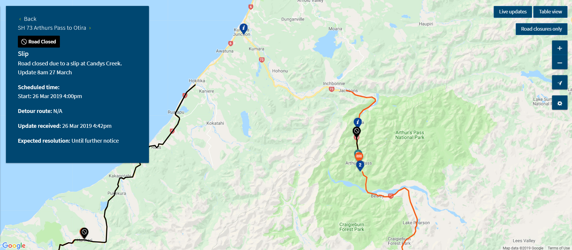
A slip at Candys Creek, State Highway 73, the Arthur’s Pass/ Otira route between the West Coast and Canterbury, has closed the highway at that point.
It will be reassessed Wednesday morning with an update around 8am.
“Given the high rainfall forecast for tonight for Otira, we have made a call to keep this highway closed,” says Transport Agency Network Manager, Colin Hey.
The Lewis Pass via Reefton and Waipara, SH7, is the other key route between the West Coast and Canterbury which remains open.
While people are encouraged to restrict journeys in the heavy rain conditions to only essential trips, anyone travelling between the West Coast and Canterbury should check this page for updates: www.journeys.nzta.govt.nz/traffic/west-coast(external link)
State Highway 73 slip: www.journeys.nzta.govt.nz/traffic/roadclosures/250864(external link)
*Update on South Westland, SH6, closure here: West Coast’s South Westland highway – closure extended from south of Hokitika to Makarora, Otago
West Coast Emergency Management/ Civil Defence Facebook:
www.facebook.com/emergencywestcoast(external link)
Westland District Council Civil Defence updates:
www.westlanddc.govt.nz(external link)
WDC Facebook:
www.facebook.com/westlanddistrictcouncil(external link)
West Coast Regional Council rainfall and river data:
www.wcrc.govt.nz/our-region/river-level-and-rainfall/Pages/default.aspx
(external link)data.wcrc.govt.nz/cgi-bin/HydWebServer.cgi(external link)
MetService:
www.metservice.com/warnings/severe-weather-warnings(external link)
Plan ahead for a safe, enjoyable journey this summer. Keep up to date with: