 Integrating land-use planning, urban design and transport planning with ONF.
In September and October of 2020, two workshops were undertaken with QLDC to trial the detailed design concepts for Movement and Place classification. Of particular interest was the applicability of the ONF framework to facilitate multi-disciplinary discussions between practitioners involved in transport planning, asset management and operations, and those involved in urban planning and urban design.
QLDC were approached as they had two current projects that provided excellent test cases for the ONF approach where the use of ONF’s common language to foster collaboration between transport and urban planners and designers could be assessed. The first was a street-scape upgrade project with the Queenstown town centre precinct, that also considered a planned arterial bypass. The other was a greenfield development at Ladies Mile east of Queenstown that was about to go out for community consultation.
This case study outlines some of the features of ONF that were examined during the workshops and their use in supporting meaningful multi-disciplinary conversations that integrate land-use planning, urban design and transport planning.
Queenstown town centre is one of the most significant places in New Zealand. It is at the centre of New Zealand’s tourism industry, the jump off point for the area’s adventure tourism industry, and a significant tourist attraction in its own right.
At the time of the workshop with QLDC, there were a number of initiatives underway looking at both the movement and place aspects of the town centre, including:
This made it an attractive test site for the ONF project to trial the movement and place classification framework in a location that had locations of high place function and some challenges to address in people movement.

The Mall.
Queenstown, having locations of high place significance in terms of their importance to the local and national economy meant there was potential for the Place value in classification to be overstated when considering the intended functions of streets. The primary consideration in classifying Place is its function, not its form. This means that places with a high aesthetic value (scenic places) do not directly equate to a high Place function.
The ONF recommends that the first consideration in classification is determining what the intended function of a street or path is, and only using the metrics provided in the ONF guidance if general agreement cannot be reached during classification discussions.
Two examples of this was discussed at the workshop with QLDC on the town centre, both involving off-carriageway routes.
The waterfront esplanade in Queenstown is probably the busiest pedestrian path in New Zealand outside the large metropolitan centres. Virtually every tourist traverses the path around the town centre waterfront during their visit. This translates in classification terms to a route that has high Movement function, and a location that has a significant Place value based on the level of activity, and the value of the place in terms of contribution to the economy and significance to the community. Taking a purely quantitative approach to classification would indicate that the corridor would therefore be considered a city hub. However, when you consider the intended function of the corridor it is a civic space. This is influenced by what the space is intended to be used for, ie a place for people to gather, dwell and enjoy the experience, with the pedestrian movement being secondary.
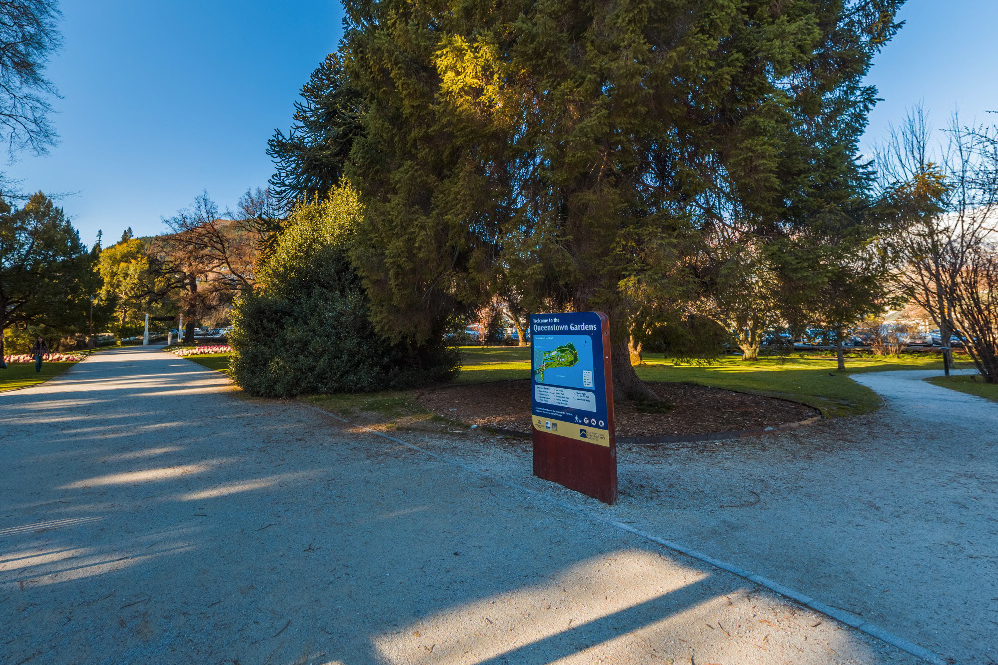
Queenstown Gardens is a park close to Queenstown town centre and includes paths that make it an attractive route for pedestrians and cyclists travelling from Frankton Arm into the town centre. Discussion in the workshop centred on the high volumes of foot and cycle traffic using this route, with an elevation of the movement rating for the pathway causing it to be classified as an activity street. Like the waterfront esplanade, the intended function and therefore correct classification for the path is as a civic space. Under ONF, if a desire line route is being used as a ‘rat-run’ elevating its movement rating, the route should still be classified based on its intended function. Transport and urban planning, considering the future intended function of routes can then address moving traffic onto preferred alternate routes.

Queenstown Gardens.
ONF introduces the concept of the future intended function view of the network. This key enhancement allows all those involved in the planning for urban growth, district planning and transport planning to utilise the framework and collaborate on the determination of the future transport networks needed to support longer term planning.
During the workshop participants were given maps and asked to classify the Queenstown town centre both in terms of the current function, and the future intended function based on known planned changes to land-use and the transport network. Participants were able to consider the impact of planned changes not just on the corridors that were changing, but also on the adjoining streets.
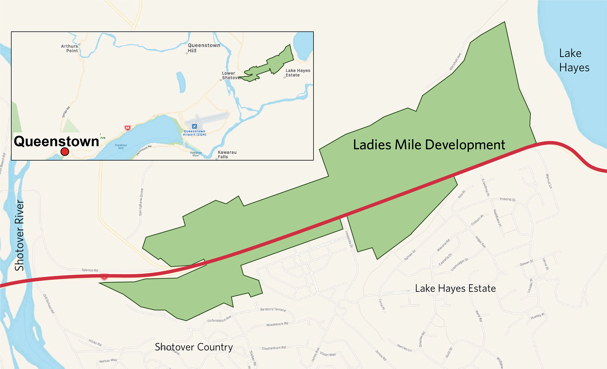
Ladies Mile is an area 10km east of Queenstown along SH6 between the Shotover River and Lake Hayes. Urban development of a greenfield site is planned that could deliver up to 2400 dwelling units. The development was used as a trial as it had a number of features which provided challenges to both transport planning and land-use planning/urban design, including:

Extent of Ladies Mile development.
To test the framework, workshop participants were given a map view of one potential layout of the development, showing facilities such as town centres, schools and recreational facilities. The map had the main transport corridors overlaid and a discussion was facilitated about the appropriate street category for each section of network.
The group were able to quickly determine appropriate street categories for the key routes throughout the development based on factors such as:
As this is a greenfield site, there were no indicative numbers to use to determine the level of movement, and therefore was a qualitative process.
The encouragement of active modes of transport, walking and cycling, for movement within the development and linking to the adjoining established neighbourhoods of Lake Hayes Estate and Shotover Country are a key consideration of the design of the development. This requirement impacts both the urban design of the development, by ensuring access to amenities such as shops, public transport, schools and recreational facilities are within walkable distance, and for transport network design, through ensuring key connections are identified and logically link to the wider transport network outside the development.
The area is well served by existing cycling and walking paths and the Ladies Mile development will provide further connectedness to the existing Wakatipu Basin active travel network. Using a map view of the existing and proposed primary and secondary walking and cycling networks for the area, a productive discussion was undertaken at the workshop on planning the active travel routes that will be attractive for pedestrians and cyclists and so encourage use of these modes of travel.
Discussion on active modes also considered the use of the WS (Walking Special) and CR (Cycling Regional) categories. Many of the walking and cycling routes around Ladies Miles serve as tourism and recreation pathways. It was decided that while tourists are using a cycling path to access a tourism destination the path is being used for a transport function and therefore should be classified as C1, C2 or C3. CR should only be used when the experience of traversing the path is the main purpose of the trip.